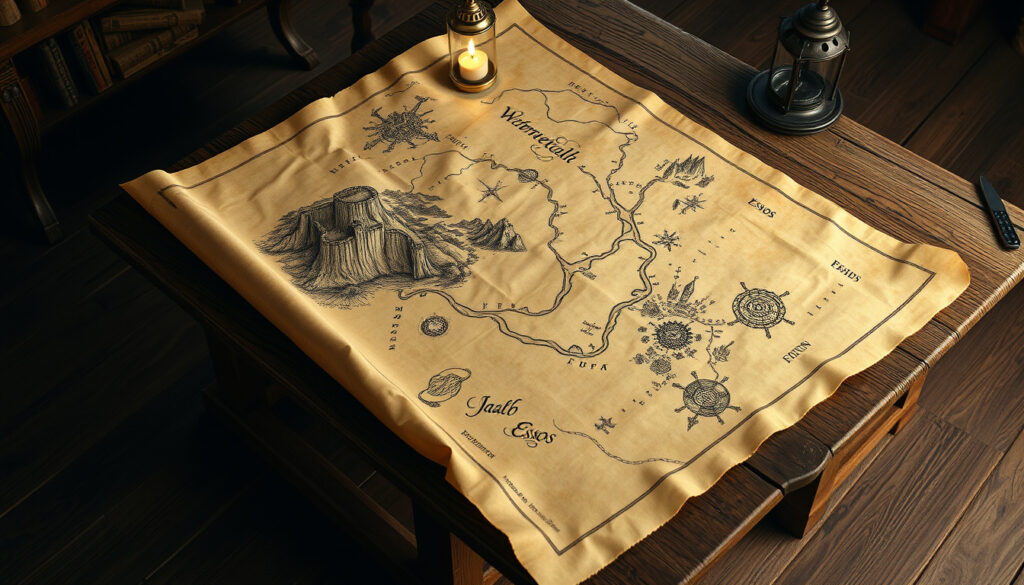
Game of Thrones Map – Interactive Westeros Essos Guide
The world of Game of Thrones spans two vast continents and dozens of distinct regions, each shaped by centuries of history, conflict, and the ambitions of powerful noble houses. Understanding the geography of this fictional realm has become essential for fans seeking to follow character journeys, political alliances, and military campaigns across the known world.
Maps of Westeros and Essos have evolved significantly since George R.R. Martin first sketched his imagined world in the pages of A Song of Ice and Fire. The official cartography, refined over decades, now encompasses everything from the frozen wilderness beyond the Wall to the mysterious cities at the edge of Essos. Whether consulting interactive online tools or studying detailed printable maps, fans have access to an unprecedented level of geographic information.
This guide examines the canonical Game of Thrones map, explores key regions and their strategic importance, and provides resources for fans who want to navigate the Seven Kingdoms and beyond in greater detail.
What Does the Game of Thrones Map Look Like?
The official Game of Thrones world map represents one of the most detailed fictional cartography projects in modern literature. These maps were created by artist Jonathan Roberts for Random House’s 2012 collection “The Lands of Ice and Fire,” based directly on George R.R. Martin’s original hand-drawn sketches. The collection spans 72 square feet across five 3×2-foot posters, making it the most comprehensive canonical representation of the known world.
Seven Kingdoms plus The Wall and the Far North
Free Cities to Dothraki Sea and beyond
Approximately 3,000 miles North-South
A Song of Ice and Fire book series
These official maps from A Wiki of Ice and Fire remain the only canonically approved cartography extending to eastern Essos beyond the Bone Mountains. The collection includes detailed depictions of the Westeros kingdoms, Free Cities such as Braavos and Pentos, the Dothraki Sea, Slaver’s Bay with its major cities of Meereen, Yunkai, and Astapor, castles North of the Wall, and King’s Landing.
Key Insights About the Map
- The Wall stretches roughly 300 miles across the northern border of the Seven Kingdoms, defended by the Night’s Watch from seventeen castles
- The Narrow Sea separates Westeros from Essos, with King’s Landing located on its western shore and various Free Cities on the eastern coast
- The Riverlands sit at the geographic heart of Westeros, making them a frequent battleground between rival houses
- The North occupies nearly one-third of the total landmass of Westeros, yet remains sparsely populated due to its harsh climate
- Essos extends far eastward beyond the Bone Mountains, reaching territories rarely visited by main characters, including Asshai and the Land Under Shadow
- The Dothraki Sea covers vast grasslands where khalasar clans roam, largely avoiding the major cities along Essos’s western coast
| Feature | Description | Approximate Length |
|---|---|---|
| The Wall | Ice fortification protecting the Seven Kingdoms | 300 miles |
| North-South Westeros | Wall to Dorne | 3,000 miles |
| Narrow Sea | Body of water between continents | Varies (300-500 miles) |
| King’s Landing to Winterfell | Major journey in early seasons | ~1,200 miles |
| Kingsroad | Main north-south highway of Westeros | ~1,800 miles |
| Westeros Width | East-west measurement | ~900 miles |
Key Regions and Locations on the Westeros Map
The Seven Kingdoms of Westeros represent the political and cultural heart of the Game of Thrones universe. Following Aegon the Conqueror’s unification, these formerly independent realms now operate as provinces under a single Iron Throne, though their distinct identities, traditions, and rivalries persist throughout the series.
The Seven Kingdoms Explained
Each of the Seven Kingdoms takes its name from its historical ruling house, though centuries of marriage and politics have shifted the actual seat of power in several regions. Understanding these territories is essential for following the complex political landscape that drives much of the series’ conflict.
- The North remains the largest kingdom, ruled from Winterfell by House Stark. Its cold climate, vast forests, and proximity to the supernatural threat beyond the Wall give it unique significance in the overall narrative.
- The Vale of Arryn centers on the Eyrie, an impregnable mountain fortress ruled by House Arryn. The region is protected by the Mountains of the Moon and remained largely uninvolved in early conflicts.
- The Iron Islands occupy a harsh archipelago on the western coast, home to House Greyjoy and a reaving culture that prizes maritime strength above all else.
- The Riverlands span the fertile valleys of the Trident River. Riverrun, seat of House Tully, commands this strategically vital but diplomatically vulnerable territory.
- The Westerlands contain the gold mines that fund Casterly Rock, seat of House Lannister, making this one of the wealthiest regions in the realm.
- The Stormlands take their name from the frequent storms that batter their coastline. Storm’s End, home of House Baratheon, has stood for millennia.
- The Reach represents the agricultural heartland of Westeros, with Highgarden ruled by House Tyrell controlling the most fertile lands and largest army.
Dorne, though technically the ninth region under Targaryen rule, maintains distinct legal traditions and is often counted separately from the traditional Seven Kingdoms.
Winterfell: Heart of the North
Winterfell, seat of House Stark, appears throughout the series as both a literal location and symbolic anchor for themes of loyalty, winter, and honor. The interactive maps at Quartermaester show its position in the wolfswood forest, ancient even by the standards of Westeros, with distinctive hot springs that warm its interior chambers.
North of Winterfell, the landscape transitions from managed forest to the haunted territories beyond the Wall. Castle Black and the other Night’s Watch castles mark the boundary between civilized Westeros and the wilderness where the White Walkers dwell.
The distance from Winterfell to King’s Landing roughly equals scaling a journey from London to Edinburgh by a factor of ten, illustrating the massive scale of Westeros compared to familiar real-world geography.
Exploring Essos and the Wider Game of Thrones World
Essos presents a stark contrast to the feudal politics of Westeros. Where the western continent is defined by hereditary nobility and territorial claims, Essos encompasses a dizzying variety of cultures, governments, and civilizations spread across a landmass larger than its neighbor.
The Free Cities
Nine independent city-states line the western coast of Essos, collectively known as the Free Cities. These trading hubs developed after the decline of the Valyrian Freehold and maintain distinct identities despite sharing certain cultural elements. Braavos, perhaps the most fascinating, operates as a secretive banking power with its own navy and a unique government structure built around the Sealord.
Other Free Cities include Pentos (where Daenerys first finds refuge), the merchant republic of Tyrosh, the religiously governed Norvos, and the fading grandeur of Volantis. Each city maintains its own coinage, laws, and relationships with the distant kingdoms of Westeros.
Slaver’s Bay and the Dothraki Sea
The southern reaches of Essos feature three major slave-trading cities along Slaver’s Bay: Astapor, Yunkai, and Meereen. Daenerys Targaryen’s conquest of these cities marks a pivotal shift in both her storyline and the political landscape of eastern Essos. Omniatlas provides seasonal maps that document these territorial changes throughout the television series.
Between these cities and the Free Cities lies the Dothraki Sea, an immense grassland where horse-lords organize into khalasars. The Dothraki fundamentally shaped Daenerys’s development as a character, and her acquisition of their largest khalasar transforms her from refugee to conqueror.
Interactive and Printable Game of Thrones Maps
For fans seeking to explore Westeros and Essos in greater depth, several online resources offer interactive and downloadable map options. These tools range from simple location finders to sophisticated political atlases tracking faction control across the seasons.
Interactive Map Tools
Quartermaester.info stands out as the most comprehensive free interactive map available. Built using Google Maps API with custom tiles created by artist theMountainGoat, it allows users to zoom from a world view down to individual city blocks in King’s Landing. The site includes spoiler controls that let readers filter information based on their progress through either the books or television series, along with wiki links for each location.
For those interested in political changes over time, Omniatlas maps the faction control at the start of each television season, clearly showing how territory shifted during the War of Five Kings and beyond. This resource proves particularly valuable for understanding the strategic implications of various plot developments.
Creative fans can also use MapChart.net’s customizable Westeros template to create their own territorial maps, coloring individual kingdoms and labeling house territories according to their preferences.
Printable Maps and PDFs
While no official high-resolution PDFs are directly available from HBO or Random House, several unofficial sources provide detailed printable options. The Unseen Westeros Map available on Scribd labels major sites including Winterfell, King’s Landing, The Wall, Harrenhal, and Storm’s End, along with Essos cities and regions extending to Valyria and Yi Ti.
Academic sources like the University of Toronto’s map collection offer cleaner versions suitable for educational use, depicting the Seven Kingdoms south of the Wall alongside an Essos overview showing the Narrow Sea, Free Cities, and Dothraki plains.
Additional printable resources include the Westerosmap.pdf created from Cartographer’s Guild shapefiles, and the GoT Map PDF covering both continents including territories Beyond the Wall.
Low-resolution official maps are included with Random House’s iOS and Android applications. For high-resolution poster prints, the artist’s official site offers the complete collection for purchase.
Westeros Size and Real-World Comparisons
Understanding the scale of Westeros helps contextualize character journeys, military movements, and the logistics of medieval-style warfare depicted in the series. The continent stretches approximately 3,000 miles from north to south, comparable in length to South America or Africa, though significantly narrower at roughly 900 miles east to west.
This scale explains why travel times feature prominently in the narrative. A journey from King’s Landing to Winterfell covers approximately 1,200 miles, comparable to traveling from London to Edinburgh multiplied by ten. The Kingsroad, Westeros’s primary north-south highway, stretches approximately 1,800 miles through every major kingdom.
How the Map Changed Across Seasons
The Game of Thrones television series fundamentally altered the political geography of Westeros over its eight-season run. These changes reflected the show’s evolving focus and the shifting balance of power across the fictional world.
- Season 1: Robert Baratheon rules the Seven Kingdoms from King’s Landing while Daenerys Targaryen begins her journey in Essos across the Narrow Sea.
- Seasons 2-4: The War of Five Kings fragments Westeros into competing claims. The Stark loyalists in the Riverlands, Lannister-controlled Crownlands, Baratheon strongholds in the Stormlands, and Tyrell alliance in the Reach each control significant territory.
- Season 5: Daenerys consolidates control of Meereen in Slaver’s Bay while Jon Snow commands the Night’s Watch defending the Wall against Wildling migration.
- Season 6: Political power shifts dramatically as various houses rise and fall. Daenerys returns to the Dothraki Sea with a newly unified khalasar.
- Seasons 7-8: Daenerys invades Westeros with her Unsullied army, Dothraki horde, and three dragons. The White Walker threat materializes beyond the Wall, briefly unifying fractured kingdoms against a common enemy.
The canonical map sources reflect book-based geography rather than show changes, preserving George R.R. Martin’s vision of the world independent of television adaptation decisions.
What We Know Versus What Remains Unclear
Fans consulting Game of Thrones maps encounter a distinction between firmly established canonical geography and areas that remain deliberately ambiguous. Understanding this distinction helps avoid confusion when comparing different sources or interpreting character movements.
| Established Information | Areas of Uncertainty |
|---|---|
| Westeros political boundaries and major cities | Precise distances between minor locations |
| The Wall’s location and length (300 miles) | Full extent of territories east of Asshai |
| Free Cities along western Essos coast | Whether Sothoryos and Ulthos are habitable continents |
| River systems (Trident, Blackwater Rush) | Detailed show versus book geography differences |
| House seats and regional capitals | The exact climate and terrain of extreme northern regions |
Historical and Cultural Context
The geography of Westeros and Essos reflects George R.R. Martin’s deliberate drawing from real-world history, mythology, and cartographic traditions. Medieval European political structures provided the foundation for the Seven Kingdoms, while the Free Cities echo Mediterranean trading republics like Venice and Genoa.
The Wall itself references Hadrian’s Wall and other frontier fortifications separating “civilized” populations from perceived threats beyond the boundary. Northern geography strongly parallels Scottish highlands and Scandinavian landscapes, while Dorne’s desert climate and distinct cultural practices mirror regions of Spain and North Africa.
This grounding in recognizable historical patterns helps explain the series’ international appeal. The Game of Thrones Fandom Wiki’s world map documents these influences alongside the fictional geography, providing context for fans interested in the creative sources behind Martin’s imagined world.
Jonathan Roberts’ official collection from Random House represents the only maps approved by George R.R. Martin himself, ensuring they accurately reflect his vision for the known world as established across all published books in the A Song of Ice and Fire series.
Summary
The Game of Thrones map encompasses two massive continents shaped by centuries of political intrigue, warfare, and cultural development. From the icy fortifications of the Wall to the mysterious cities at the edge of Essos, the geography of this fictional world provides essential context for understanding the series’ complex narrative.
Fans have access to an unprecedented range of cartographic resources, from interactive online tools to printable PDFs and high-resolution official collections. Whether following established canonical geography or exploring the uncertain territories beyond mapped regions, these resources help bring Martin’s intricate world to life.
Frequently Asked Questions
Is there an official Game of Thrones map?
Yes. Jonathan Roberts created the official maps for Random House’s “The Lands of Ice and Fire” collection in 2012, based on George R.R. Martin’s originals. This 72-square-foot collection across five posters represents the only canonically approved cartography.
Where can I find an interactive Game of Thrones map?
Quartermaester.info offers the most comprehensive free interactive map, using Google Maps API with custom tiles and spoiler controls for books and show progress. Omniatlas provides seasonal political maps showing faction control changes.
How big is Westeros compared to the real world?
Westeros spans roughly 3,000 miles north-south (comparable to South America) and about 900 miles east-west. The distance from King’s Landing to Winterfell is approximately 1,200 miles, similar to scaling a London-to-Edinburgh journey by a factor of ten.
What are the Seven Kingdoms on the map?
The Seven Kingdoms include the North (Stark), Vale (Arryn), Iron Islands (Greyjoy), Riverlands (Tully), Westerlands (Lannister), Stormlands (Baratheon), and Reach (Tyrell). Dorne, though often listed separately, operates under Targaryen rule with distinct legal traditions.
Can I download printable Game of Thrones map PDFs?
No official free PDFs exist from HBO or Random House. However, unofficial high-resolution options are available through sources like Scribd and academic repositories. The official poster collection is available for purchase through the artist’s site.
Where is Winterfell on the map?
Winterfell sits in the wolfswood forest of the North, roughly equidistant between the Wall and the southern border of the North. It is the ancestral seat of House Stark and serves as the primary location of the Stark family’s story arc.
How did the map change across Game of Thrones seasons?
Season 1 showed Robert Baratheon controlling the Seven Kingdoms while Daenerys began in Essos. Seasons 2-4 fragmented Westeros during the War of Five Kings. Seasons 5-8 tracked Daenerys’s Slaver’s Bay conquest, invasion of Westeros, and the emergence of the White Walker threat from the North.
More related posts
 Norris Nuts Real Names, Ages & Family Details Guide
 Inside Number 9 Theatre: Stage/Fright Tour 2025-2026 Guide
 Davy Crockett: Frontiersman, Politician, and Alamo Legend
 Sleep Token: The Masked Band and Why They Stay Anonymous
 Mr. Miyagi: The Character and the Actor Behind the Legend
 Black Widow Avengers: Powers, Death & MCU Legacy
 Sandra Bullock: Love, Loss, and Life After Bryan Randall
 Robbie Savage: A Fact-Checked Guide to His Life and Career